Severe rainfall is forecast to continue in already-saturated NSW and flood warning have been issued for multiple river catchments across the state.
NSW has been hit by repeated flooding in recent months, with the Northern Rivers area devastated by two deluges within weeks, and Sydney drenched in its wettest March on record.
A severe weather warning is in place for southern and central NSW, metropolitan Sydney, the Illawarra, the South Coast, the Central and Southern Tablelands and parts of the Hunter on Thursday.
Heavy rainfall fell in the Illawarra, South Coast and Southern Tablelands overnight on Wednesday and the wet weather will extend across Sydney, the Central Tablelands and Hunter region on Thursday.
Six-hourly totals between 60 and 100mm are forecast, with totals of up to 140mm predicted on the coast.
The Bureau of Meteorology warned there’s an increased risk of landslides.
A flood watch has also been issued for central NSW, with minor to moderate flooding forecast for the Southern Coastal Rivers including the Hawkesbury-Nepean, the Macquarie and Queanbeyan rivers on Thursday and Friday.
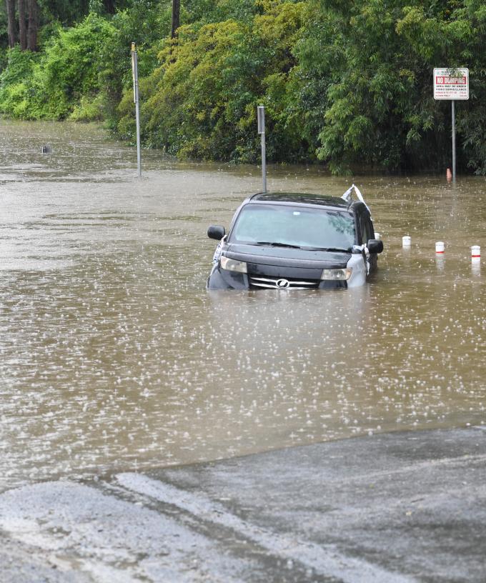
On Thursday morning, the NSW SES warned there could be major flooding in Liverpool and Milperra in Sydney’s west along the Georges River with the water expected to rise above four metres in the late afternoon on the high tide.
“Residents of areas expecting to be flooded should make plans to leave when advised to do so. Ensure you take pets and valuables with you,” the SES said.
Minor flood warnings have been issued for the Hawkesbury River at Windsor and North Richmond and the Cooks River at Tempe Bridge and the Woronora River at Woronora Bridge.
Moderate flooding could occur on the Colo River at Putty Road.
The SES said on Thurday it had conducted seven flood rescues and responded to 580 requests for help in the past 24 hours.
Catchments are already soaked after months of heavy rain, the BOM said.
The bad weather is being driven by a strong upper trough over the centre of NSW, working to deepen another trough sitting off the coast.
The systems are expected to weaken on Friday morning.
“Heavy and persistent showers over the coming days will increase the chance of flash flooding and landslips over already saturated catchments,” BOM meteorologist Sarah Scully said.
Severe thunderstorms also pose a threat, including in northeast NSW.
“They may produce localised heavy falls (but) it is not expected to produce that riverine flooding,” Ms Scully said.
“Instead, it’ll be more localised flash flooding.”
AAP